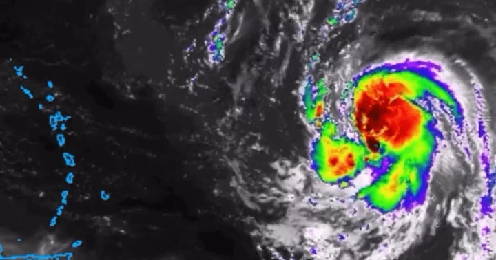
NEW YORK CITY, NEW YORK: Forecast models indicate that Hurricane Lee could bring deadly storm surges and heavy rains to NYC and Boston after strengthening into a major Category 5 storm, with wind speeds of 160 mph.
After forming as a tropical storm on Tuesday, September 5, Lee swiftly intensified into a hurricane by Wednesday afternoon.
As a Category 4 hurricane, Lee was churning in the open water to the northeast of the Caribbean on Thursday and was heading toward the Leeward Islands.
The storm has intensified during the last day, and its winds currently exceed 130 mph. "Lee continues to strengthen at an exceptional rate," the National Hurricane Center stated.
The storm is forecast to reach its peak intensity by this weekend and is still predicted to be a hazardous hurricane across the southwest Atlantic early next week.
The Hurricane Center also stated that dangerous surf and rip currents are expected to spread across the northern Caribbean on Friday and begin affecting the United States on Sunday.
Hurricane Lee's path according to forecast models
Spaghetti models, which depict computer projections of where the storm's center may be in a few days, show the storm turning northeast and moving along the East Coast.
At first, the models were speculating a landfall in the Mid-Atlantic region before riding up the coast toward New York. However, they changed on Monday and showed Hurricane Lee going out to sea.
According to CBS New York's meteorologist, the ECMWF or European model of the hurricane suggests that there is a front along the East Coast next week that could keep Lee at sea, but if it splits apart, it would pave the way for the storm to strike the Northeast.
As per this model, the storm is expected to make landfall in Massachusetts. Meanwhile, an American model depicts Lee scraping along the coast of Cape Cod, before heading into the Canadian Maritimes.
In such a case, the East Coast would still feel the impact of the storm but it wouldn't be as severe as a direct hit. On Thursday night, Lee was located about 705 miles east of the northern Leeward Islands.
Hurricane Lee's potential impact on the US
On Thursday, President Joe Biden received information about the hurricane's most recent track and the preparations being made by the US Federal Emergency Management Agency, which has sent unidentified resources to Puerto Rico and the US Virgin Islands, according to Daily Mail.
The storm is expected to cause life-threatening surf and rip currents to the Lesser Antilles on Friday. This weekend, swells are anticipated to impact Bermuda, Puerto Rico, the Bahamas, and Virginia Island in the United States.
"We will see waves between 10 and 15 feet, so we don't want anyone on the beaches," said Ernesto Morales with the National Weather Service in San Juan, Puerto Rico.
The National Hurricane Center said dangerous surf and rip currents were forecast for most of the US East Coast starting on Sunday.
Lee is the 12th named storm of the Atlantic hurricane season, which runs from June 1 to November 30, and peaks in September.


